GPS Vehicle Tracker
|

|
A "technology demonstrator"
was required to test the feasibility of using GPS recording in so-called
"road
pricing" schemes.
Early generation schemes relied upon
"beacons" mounted at the roadside and transponders in
the vehicles, or automated number plate recognition (ANPR)
- but these require costly roadside infrastructure. Logging the
position data from a GPS
receiver should allow road usage to be recorded with no roadside
infrastructure at all.
|
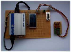
For the initial phase, we used a Fastrack
Supreme
modem (predecessor of the Sierra Wireless AirLink™ FXT)
fitted with an "IESM"
plug-in card to provide a GPS receiver and IO signals - including an SPI
bus to allow connection to an SD
Card for data recording:
We created an Open-AT
application with Wavecom's "Companion GPS" (CGPS)
plug-in, and used the popular FatFs
open-source FAT
file system for managing files on the SD Card, developing a custom driver for
accessing the SD Card via the SPI bus. We took advantage of Open-AT's
multi-tasking features to ensure that accesses to the SPI bus did not block
the GPS processing.
 The use of an SD Card and FAT file system allowed
the data to be easily transferred to a PC for analysis.
The use of an SD Card and FAT file system allowed
the data to be easily transferred to a PC for analysis.
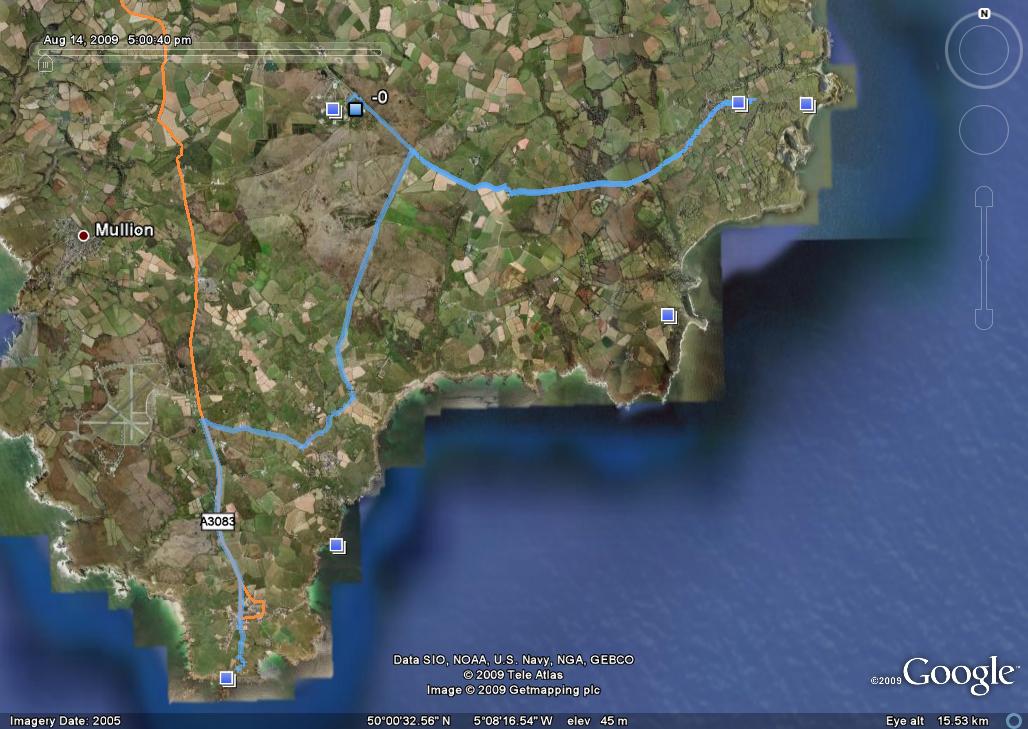
For example, the image to the right
shows the recorded track data from a drive around the Lizard
Peninsula in Cornwall, as displayed by Google Earth.
(click the image for a larger view;
the track is shown in blue).
The application was then ported to the Client's
custom hardware platform - using a Q2686
module with the GPS chipset, SD Card, etc, integrated into a single unit.